


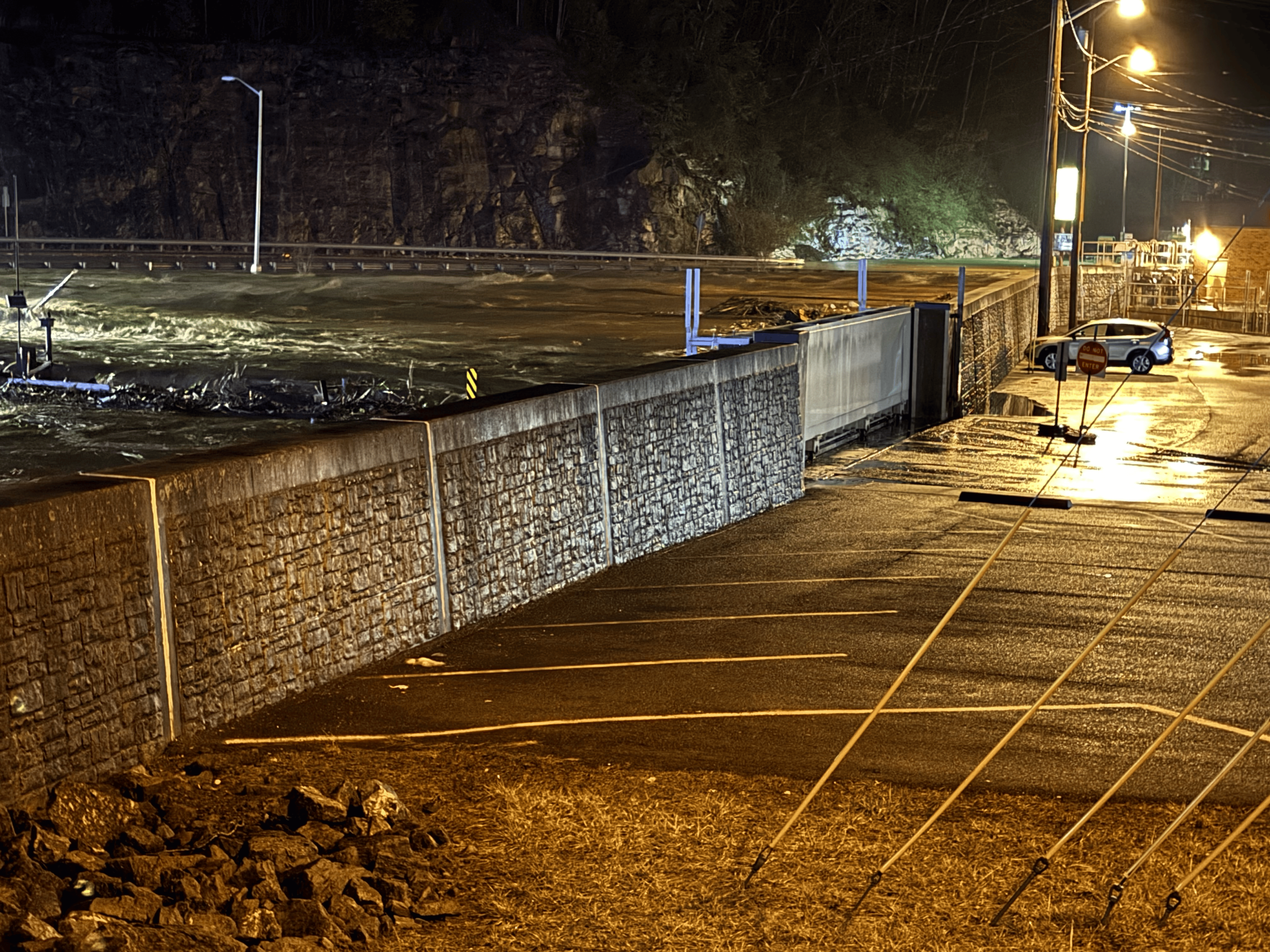
Even as nearly 21,000 Virginia utility customers remain without power from ice storm damage earlier in the week, flooding engulfed many creeks and roads across western Virginia on Saturday, and high winds could reaggravate power outage woes by late Sunday.
Heavy rainfall of around 2 to 3 inches poured onto already saturated soils, with lingering snow and ice accumulation in the mountains adding to the runoff, causing many streams and rivers to leave their banks and inundating some roadways. Saturday’s rain occurred in many areas with temperatures near or barely above the freezing mark, so some ice accretion was reported on trees and exposed surfaces in some areas, but the heavy rate of rainfall and marginal temperatures kept heavy ice accumulations comparable to those of last Tuesday and Wednesday from recurring.
“Heavy rain is hitting Virginia, with flash floods already reported in SWVA,” Gov. Glen Youngkin posted on X. “Stay alert — don’t fight the water, just leave, and call for help. First responders, rescue crews, law enforcement, VDOT, and the VA National Guard are deployed. Your safety is our top priority.”

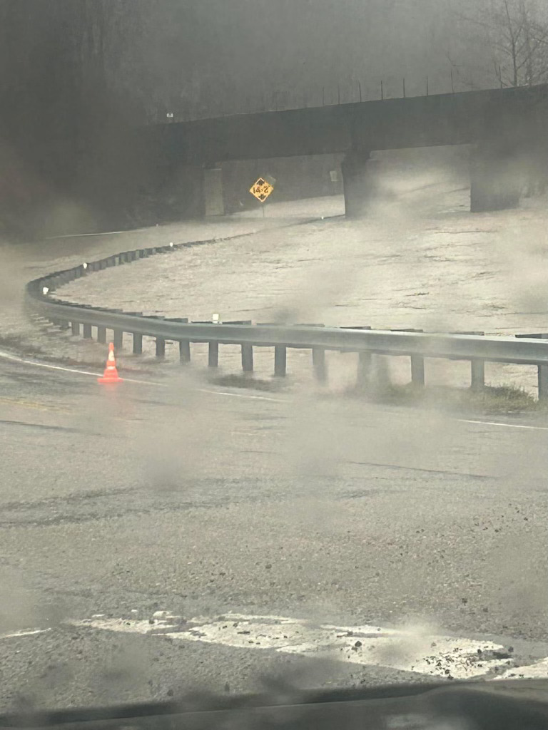
Flooding in Doran in Tazewell County. Courtesy of state Sen. Travis Hackworth. 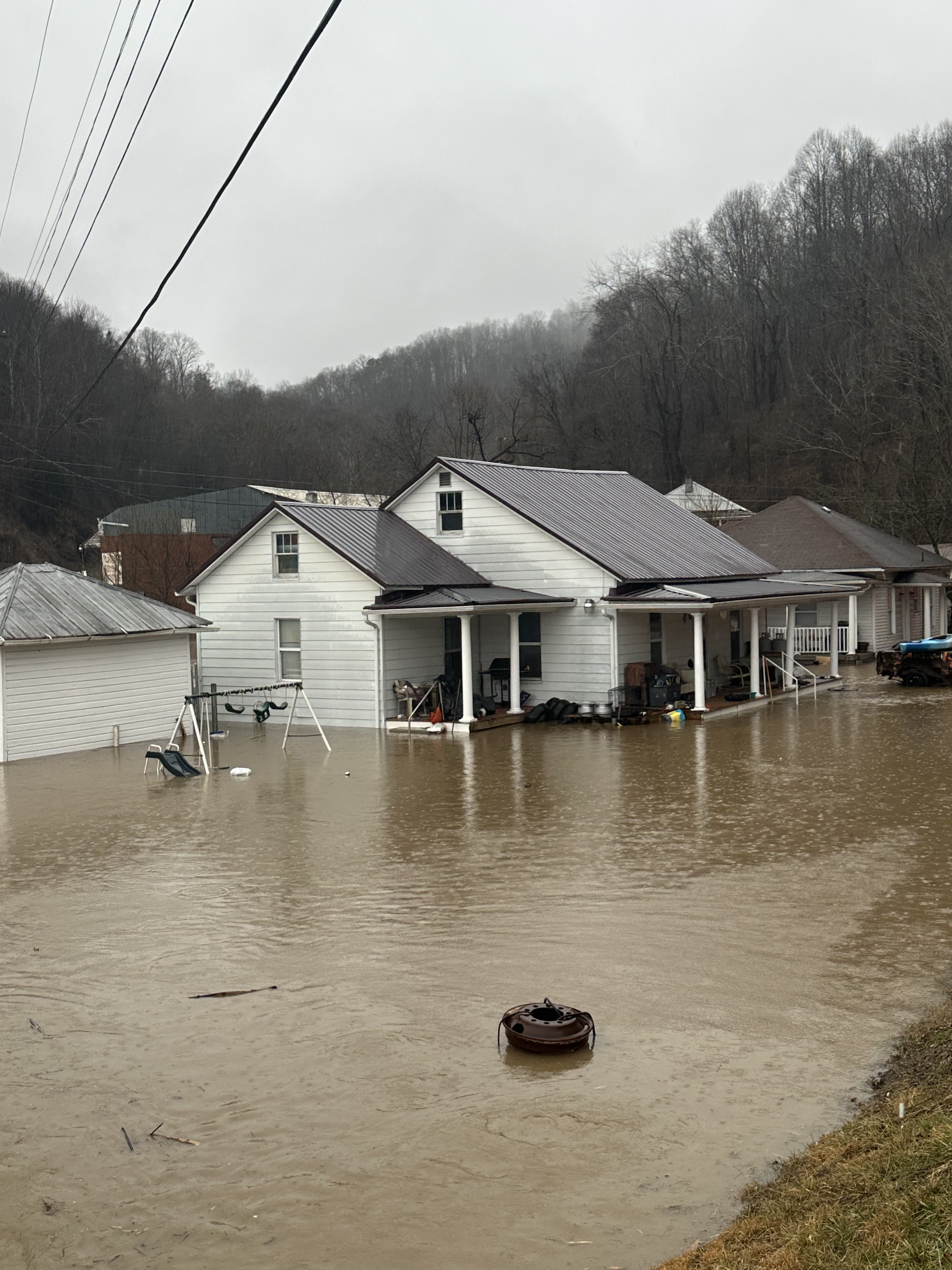
Flooding in Doran in Tazewell County. Courtesy of state Sen. Travis Hackworth. 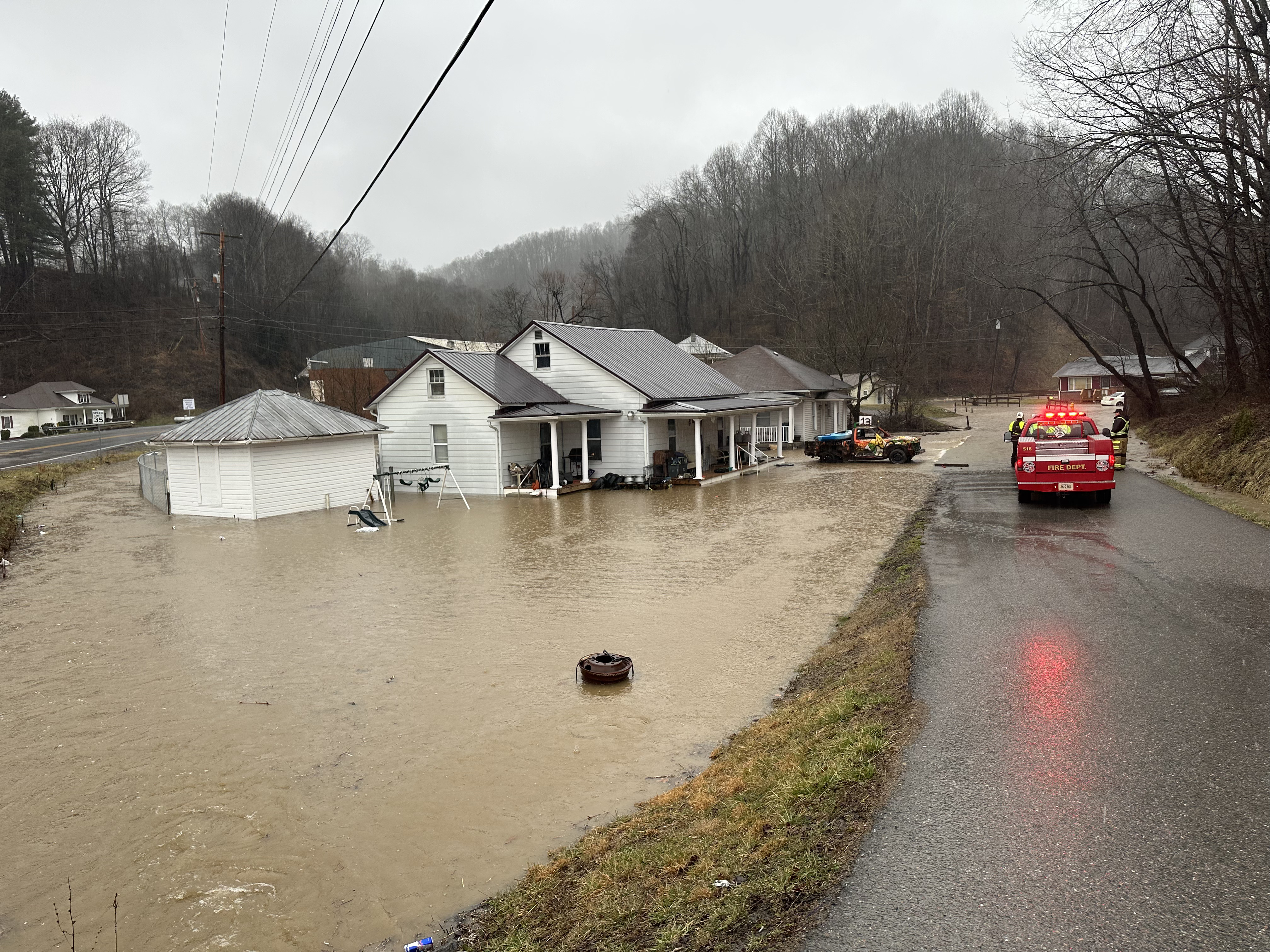
Flooding in Doran in Tazewell County. Courtesy of state Sen. Travis Hackworth. 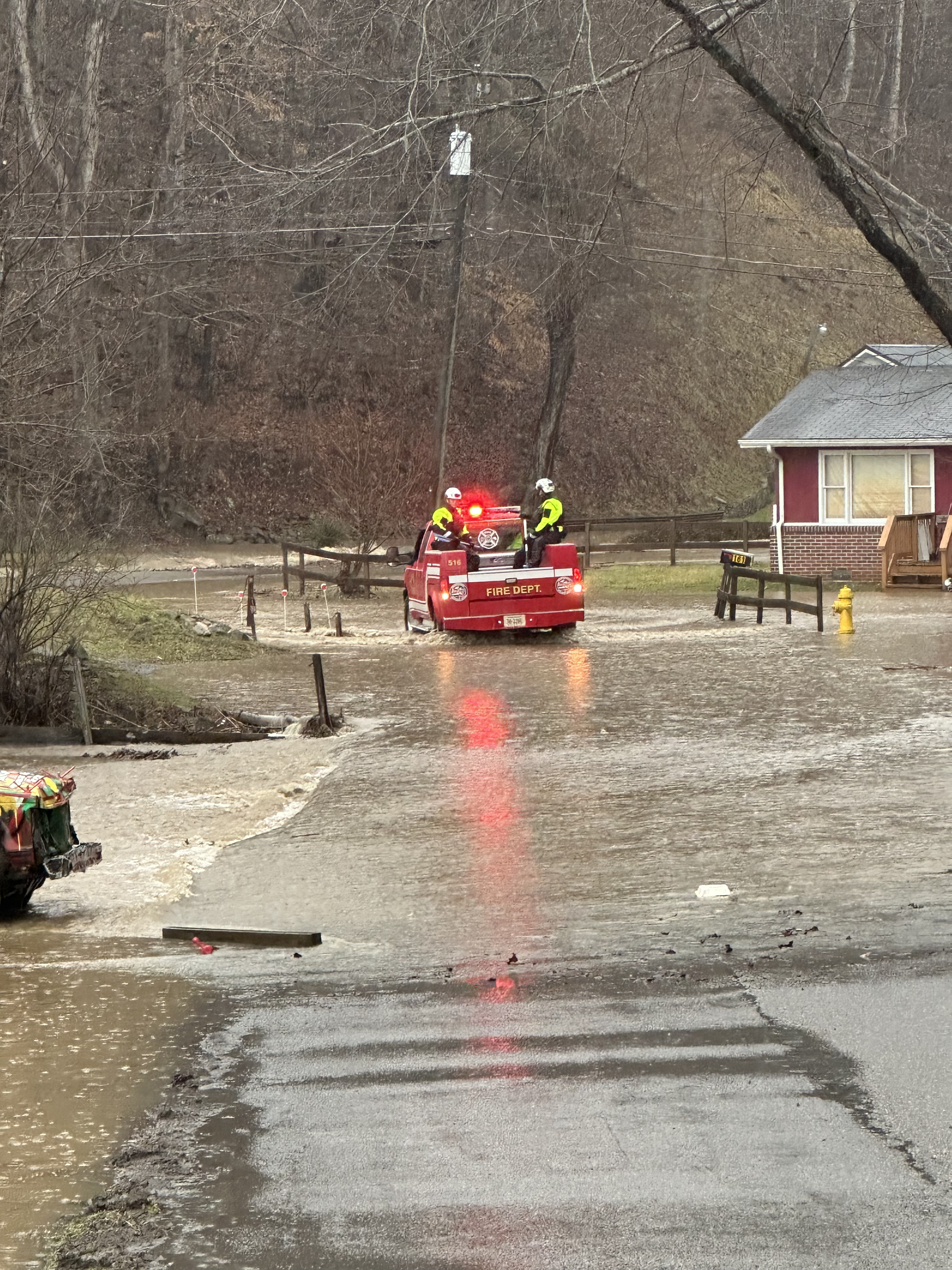
Flooding in Doran in Tazewell County. Courtesy of state Sen. Travis Hackworth. 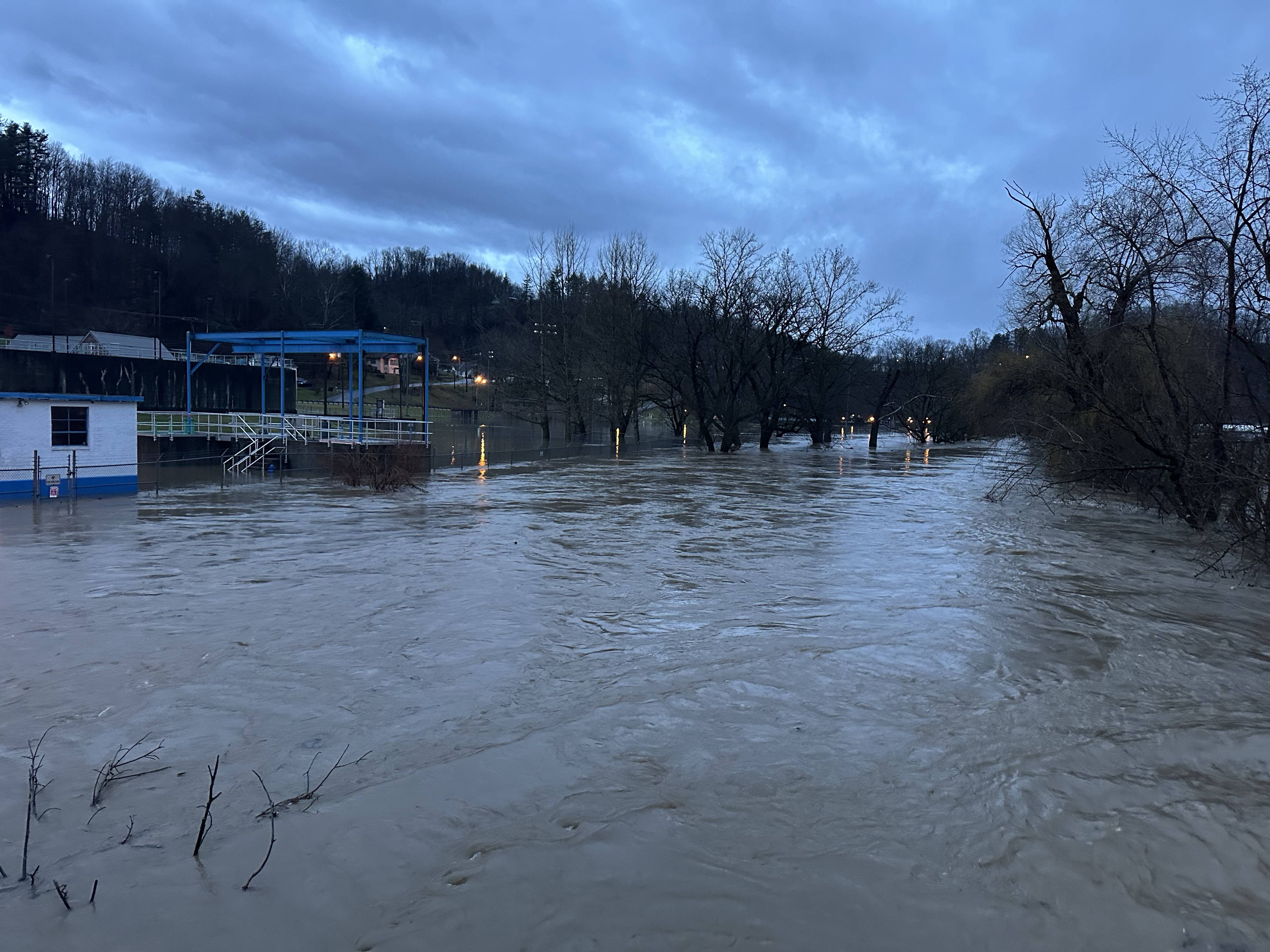
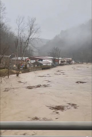
Flooding in Richlands Tazewell County. Courtesy of state Sen. Travis Hackworth. 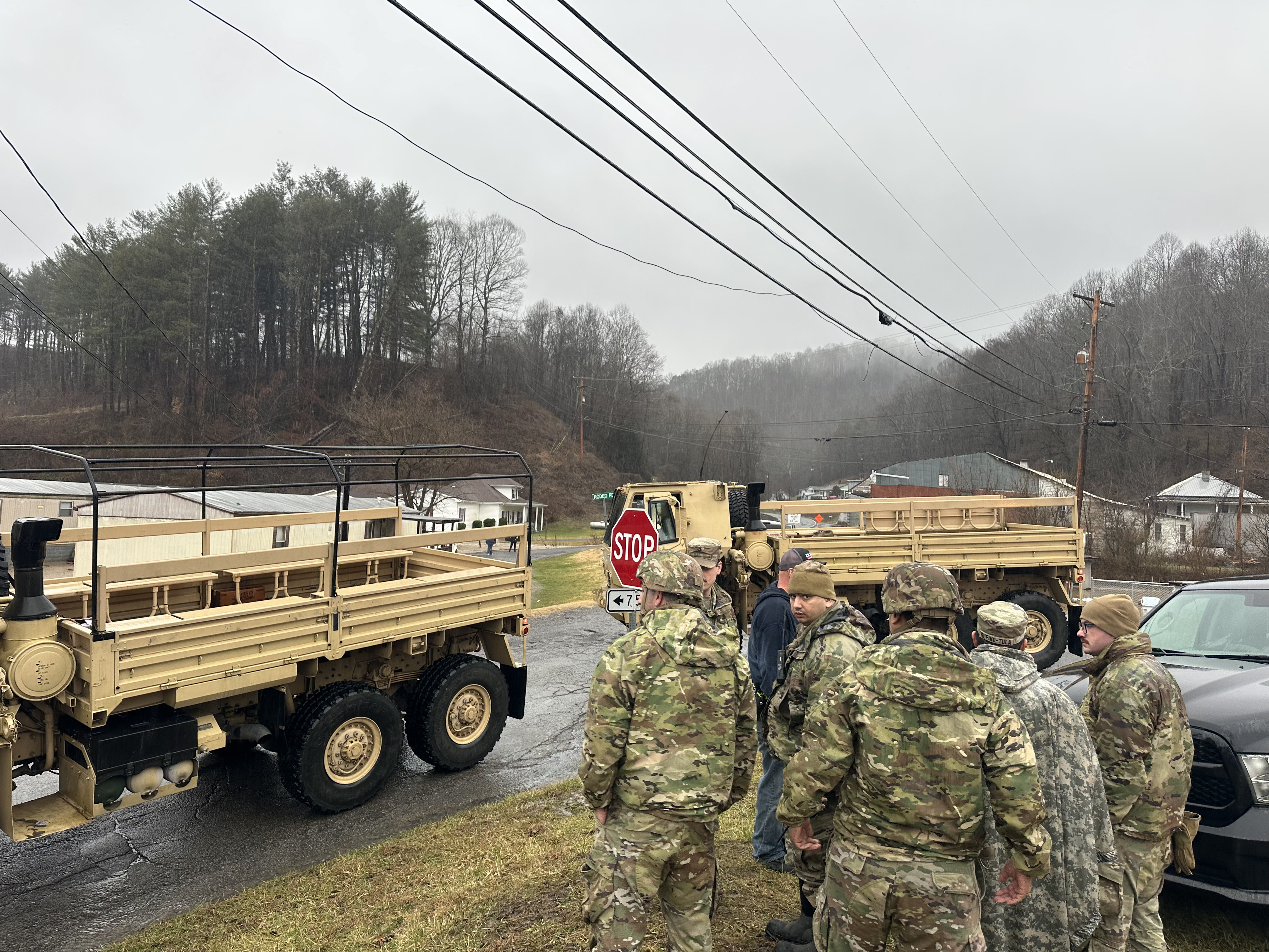
Flooding in Doran in Tazewell County. Courtesy of state Sen. Travis Hackworth. 
Flooding in Doran in Tazewell County. Courtesy of state Sen. Travis Hackworth. 
Flooding in Richlands Tazewell County. Courtesy of state Sen. Travis Hackworth. 
Flooding in Richlands Tazewell County. Courtesy of state Sen. Travis Hackworth.
Both Buchanan County and Dickenson County in Southwest County declared a local state of emergency due to flooding. “Emergency Management and law enforcement report widespread flooding, washed-out roads and bridges, mudslides, and dangerous debris in roadways,” Dickenson reported in a press release. “Many roads are completely impassable. The Virginia National Guard is en route to assist with ongoing rescue operations.” State Sen. Todd Pillion, R-Washington County, said the National Guard has been delayed by high water and is trying alternate routes to get to the county.
Updated, Feb. 16, 10 a.m.: Dickenson County reports the National Guard is now on scene in the county but that many roads remain impassable. “Emergency Management and law enforcement continue to report widespread flooding, washed-out roads and bridges, mudslides, dangerous debris in roadways, and significant damage to automobiles and homes,” the county said in a news release. “A donation center will be open at the Dickenson Center for Education and Research (818 Happy Valley Drive, Clintwood, VA. 24228) beginning at 2pm on Sunday on the back side of the building. Items needed at this time are cleaning supplies, bottled water, non-perishable food items, and baby items. The list of donations accepted will be updated as we continue to assess the needs of the residents.”
State Sen. Travis Hackworth, R-Tazewell County, was at the local command center in Richlands on Saturday night and warned: “Everyone needs to get out of their homes near the water. If they are near the Clinch River and the water is within 2 feet of their residence, they need to evacuate.” He said a shelter had been set up at the Fuller Perry building in Tazewell and that shuttles are available to transport people. “They can call 911 and we will come get them,” he said.

A very partial list of flooding reports turned in to the National Weather Service as of 7:30 p.m. include:
- Several roads are closed and impassable around Roanoke College due to flooding. Horners Branch flooding Main Street in Salem with 2 to 3 feet flowing water. Cars stalled in the flood water.
- The Roanoke River is 2 feet above its 10-foot flood stage at Walnut Avenue bridge in Roanoke and expected to crest at 13.5 feet, but that could increase with additional rain.
- Intersection of Candlers Mountain Road and Sunnymeade Road flooded at Lynchburg.
- Peak Creek flooding over Dora Highway in Pulaski County, also flooding at Heritage Park. Water starting to come out the banks in the town of Pulaski with water over Main Street.
- Neighborhood at Bane Bottom of Cedar Bluff of Tazewell County is flooded.
- Flooding at Brookside Park in Hollins neighborhood of Roanoke County.
- Toms Creek overflowing in Blacksburg.
- Jackson River exceeding its banks in Alleghany County.
- Properties along Edgewater Drive at Cedar Bluff in Tazewell County are underwater due to the Clinch River surpassing moderate flood stage.
- North Fork of Roanoke River has overflowed its banks and is flooding fields and farm properties near Catawba Road.
- Evacuations at Saltville in Smyth County.
Additional heavy rain is expected overnight and early Sunday before much drier and very briefly warmer weather moves in.
A strong cold front arriving during the day Sunday will kick up northwest winds that could gust over 50 mph at times, especially in higher elevations. The combination of strong wind gusts, wet soil, and recent ice damage will likely lead to additional power outages and continue to slow power crews from repairing those that have already occurred. 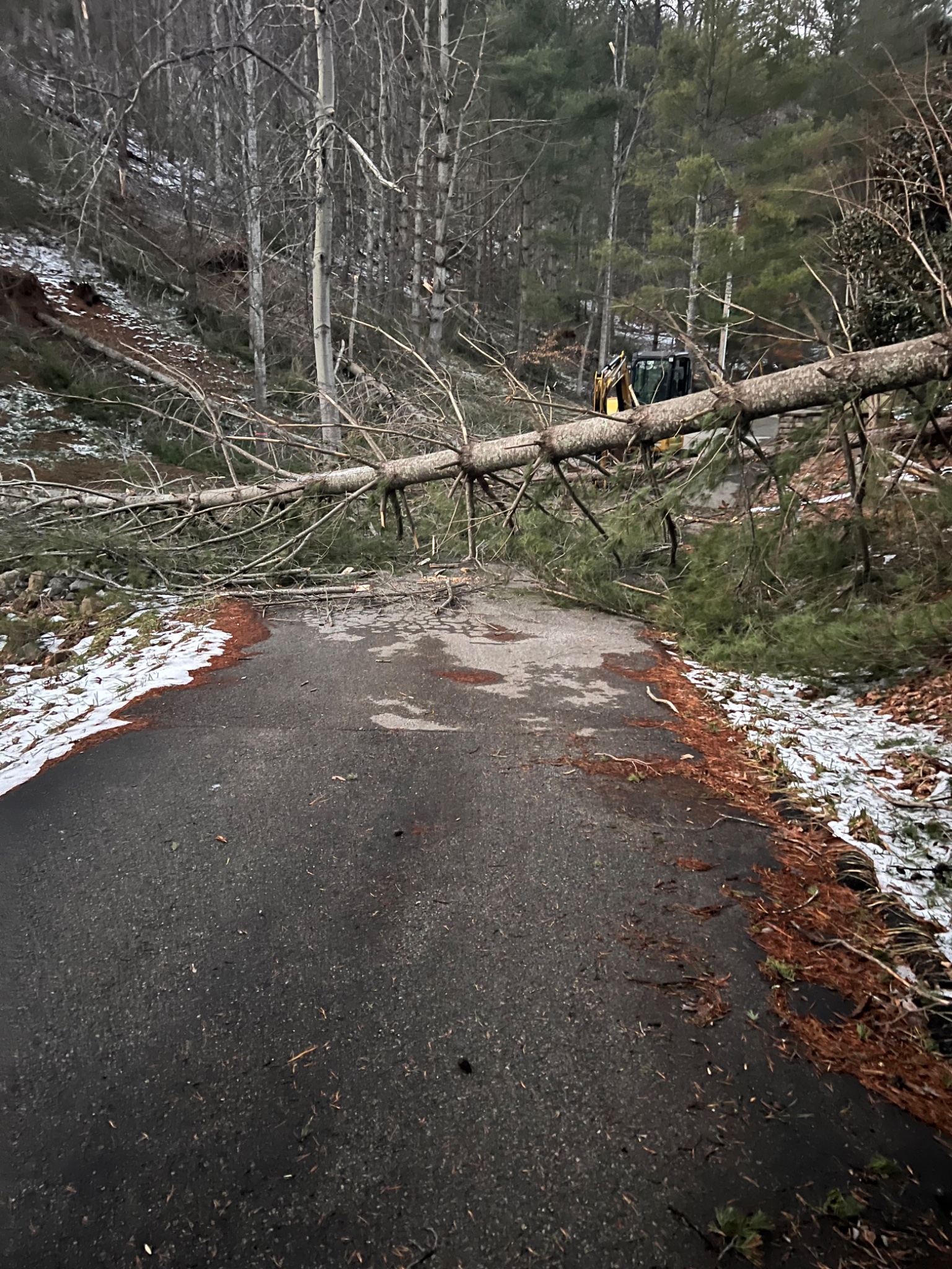
Power outages peaked at just over 200,000 customers early Thursday following a series of waves of wintry precipitation over two days, starting as snow, then sleet, then freezing rain. Ice accretions of up to ½ inch on top of 1-5 inches of wet snow resulted in widespread tree damage across many locations along and south of the U.S. 460 corridor connecting Blacksburg, Roanoke, Lynchburg and Richmond. Most locations north of the U.S. 460 corridor received 5-15 inches of snow, but generally had less ice and fewer power outages.
The majority of the power outages are in Appalachian Power’s service area. The utility said on its website that it has “3,500 line workers and thousands of assessors and forestry personnel” at work in the effort to restore power.
“Saturday night’s flash floods are delaying restoration efforts as crews travel to job sites,” Appalachian Power said on its website. “Approximately 800 locations in southern Virginia require repairs. Crews from Alabama, Indiana, Kentucky, Louisiana, North Carolina, Ohio, Oklahoma, Pennsylvania, South Carolina, Tennessee and Texas are working alongside Appalachian Power employees and contractors.”
A period of extremely active weather continues over the central and eastern U.S. as Arctic air that dominated much of January is reasserting itself against a mild dome of high pressure off the Southeast coast of the U.S. similar to those that have caused several prior winters to be relatively mild. The push and pull between the cold and mild air, augmented by several waves of stronger winds aloft moving through the jet stream, have caused a wide variety of inclement weather over several states.
The week ahead promises a turn to much colder weather with the likelihood of widespread snow for Virginia by Wednesday. 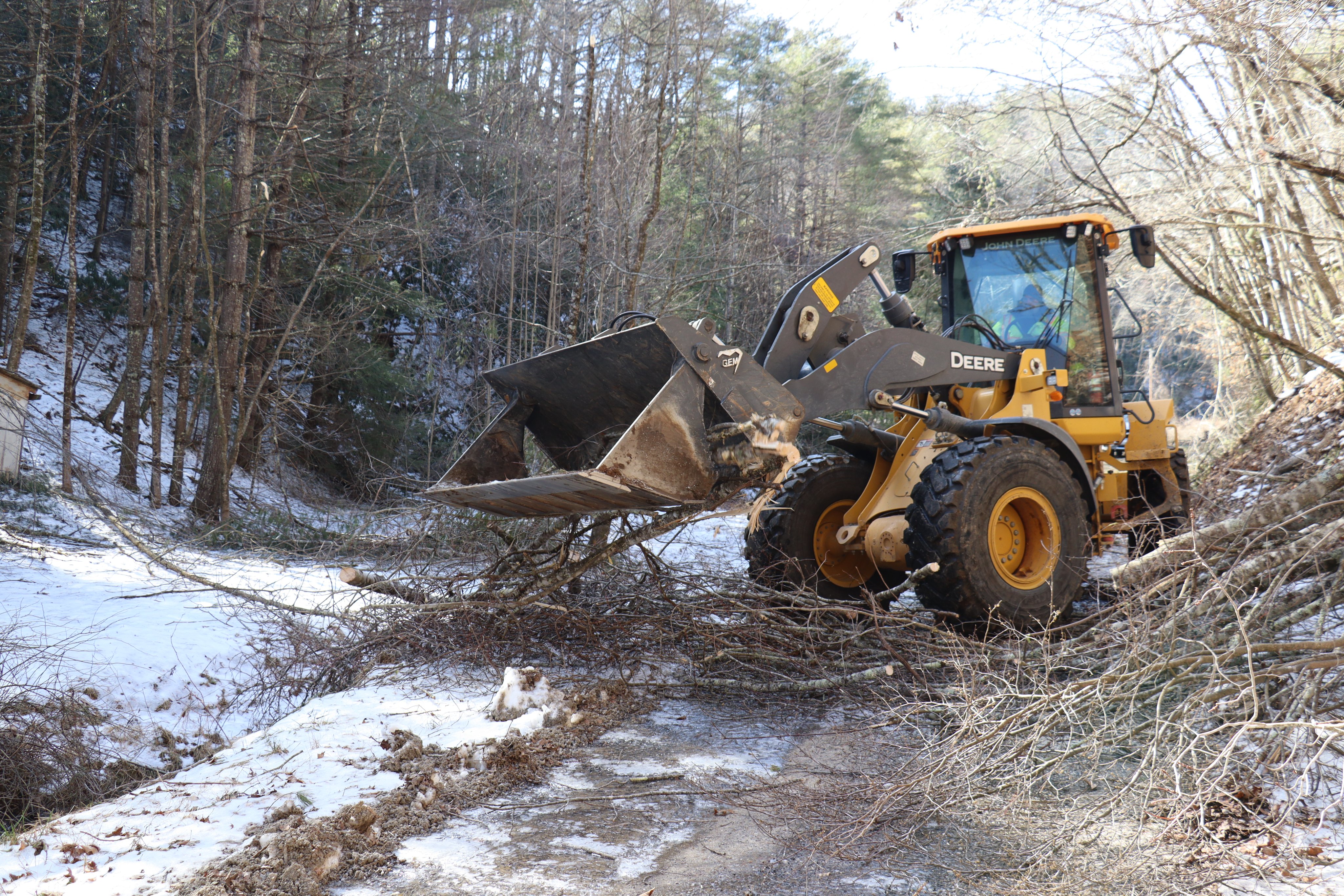
Journalist Kevin Myatt has been writing about weather for 20 years. His weekly column, appearing on Wednesdays, is sponsored by Oakey’s, a family-run, locally-owned funeral home with locations throughout the Roanoke Valley. Sign up for his weekly newsletter:
