


Other coverage of the storm:
- Saturday flooding, Sunday high winds bring additional weather woes as thousands still without power from ice
- Youngkin requests expedited federal help as parts of Southwest Virginia again face catastrophic flooding
Gusty winds roared over a flooded and ice-battered landscape on Sunday afternoon, toppling yet more trees and power lines, the latest scourge in an especially rough week of inclement weather for Virginia.
Utility crews from several states had not yet fully restored power from last week’s ice storm across southern Virginia when flooding rains swelled streams and rivers over roadways Saturday and early Sunday and then gusty westerly winds ripped behind a cold front later Sunday, the leading edge of an Arctic air mass that will set up an expected widespread snowfall by Wednesday. Some minor accumulations from mountain snow showers were possible along and west of the Blue Ridge overnight and early Monday.
After utility crews from multiple states were able to restore power by early Sunday to over 90 percent of the just over 200,000 customers who lost power from multiple rounds of wet snow and freezing rain that broke trees and power lines on Tuesday and Wednesday, high winds gusting over 50 mph had knocked power out to just over 200,000 customers again across Virginia by 5:30 p.m. Sunday, according to utility data aggregator poweroutage.us. That number is likely to climb through the night as gusty winds continue, only slowly dwindling during the day Monday. 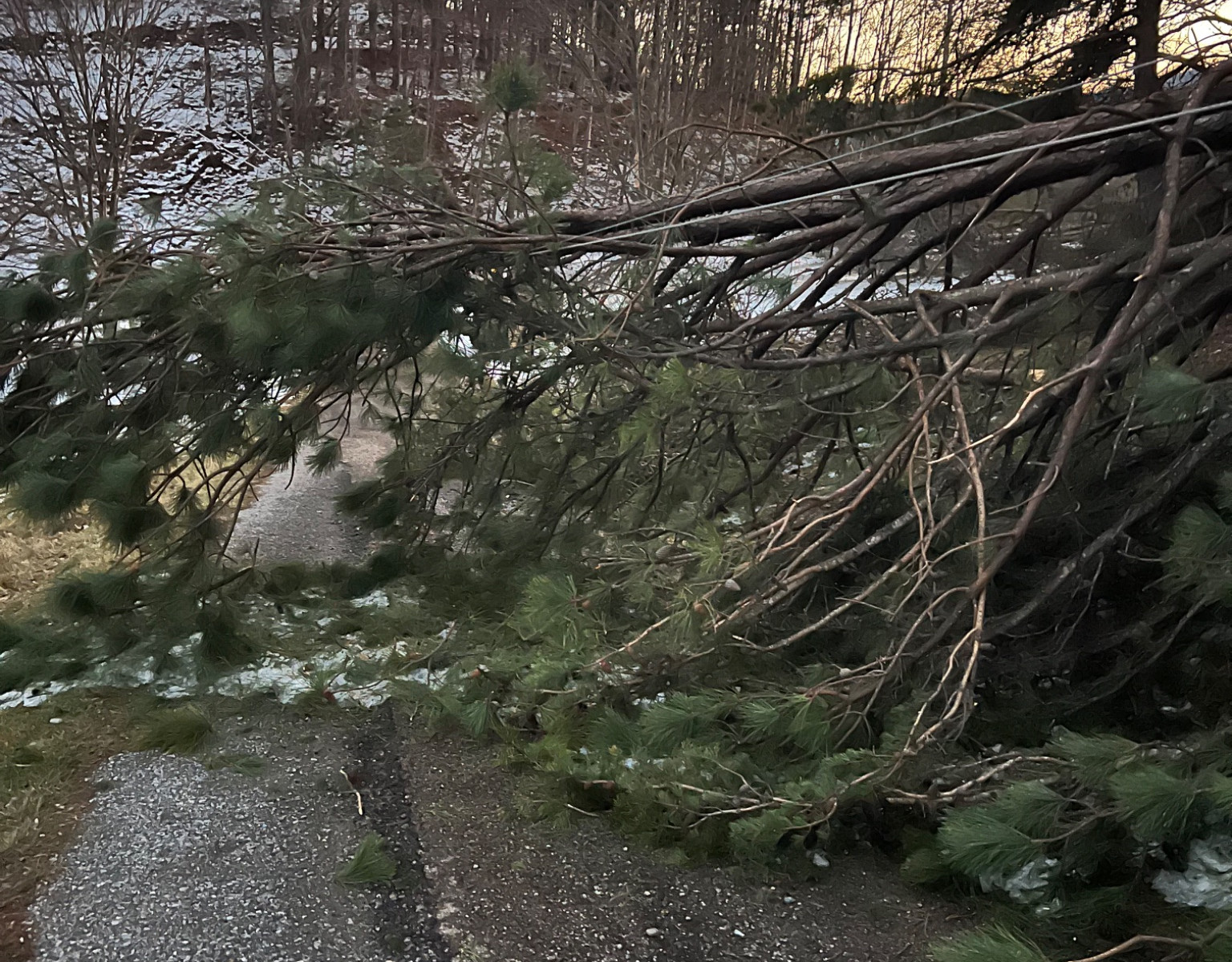
Unlike last week, power outages are not limited to a fairly narrow strip of southern Virginia, but spread out across much of the western two-thirds of Virginia, and Virginia was not alone in its power outage woes, but rather one of about a dozen states in the eastern U.S. experiencing thousands of homes and businesses losing electricity.
The strong winds are a result of the backside rotation of a deepening low-pressure system over the Northeast U.S. and the contrast between Arctic air pressing southeastward from Canada and milder air that has been parked over the southern U.S. Temperatures that had been stuck in the low to mid 30s for days shot up to as high as 60 degrees briefly Sunday afternoon in parts of Southwest and Southside Virginia before rapidly tumbling again as the cold front moved through.
Much colder air will take charge this week, with lows in the teens and 20s common and highs in the 30s and 40s, some days not getting above freezing in the latter half of the week. 
A low-pressure system tracking across the southern U.S. is expected to spread moisture into cold air on Wednesday, leading to the likelihood of widespread snow across Virginia. There are many details to be worked out, but it appears that there will be a good chance of “plowable” snow of 3 inches or more over most or all of Cardinal News’ Southwest and Southside Virginia coverage area on Wednesday with some chance of amounts of 6 inches or more particularly east of the Blue Ridge. These amounts are subject to change up or down as forecasts become more fine-tuned in the next couple of days, but widespread accumulating snow is looking very likely on Wednesday.
Wednesday’s snowfall may be the caboose on the train of recent precipitation-bearing storm systems, with calmer but very cold weather taking hold by late week.
Journalist Kevin Myatt has been writing about weather for 20 years. His weekly column, appearing on Wednesdays, is sponsored by Oakey’s, a family-run, locally-owned funeral home with locations throughout the Roanoke Valley. Sign up for his weekly newsletter:
