


As the horrible toll from extreme flash flooding mounted in Texas, another historic flooding episode snuck toward us from the south.
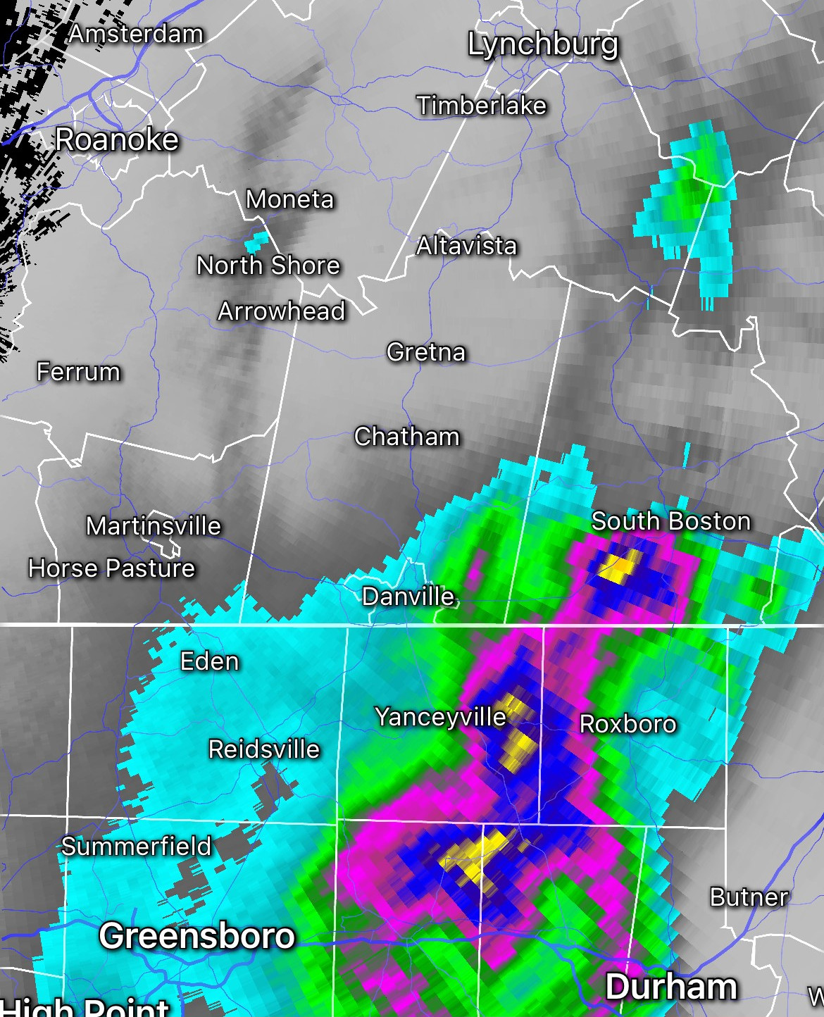
Tropical Storm Chantal formed quickly off the coast of the Carolinas over the Fourth of July weekend and, by Sunday, its remnant circulation center as a tropical depression spun across the middle section of North Carolina. A patch of counties from Interstate 40 west of Durham north to the Virginia line saw 5-10 inches of rain in just a few hours. Rivers reached close to historic watermarks set nearly three decades ago in 1996 when the core of Hurricane Fran passed over the same region in a similar manner. Many businesses in Chapel Hill suffered flood damage.
Most of the Southwest and Southside Virginia coverage area of Cardinal News was spared heavy rain and flooding from Chantal, as the system had not quite developed widely and deeply enough for a persistent flow of tropical moisture over our region. No rain at all fell over most of the New River Valley and points west to the southwest corner, and most locations only got a few tenths of an inch from the Blue Ridge eastward.
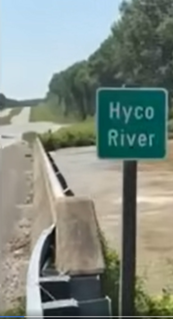
But North Carolina’s cloudburst rains did make it just over the border into Southside, with the southern half of Halifax County especially hard hit as 3-7 inches of rain fell in a few hours. Several roads were closed and the Hyco River overflowed U.S. 501. On Virginia 58, a large sinkhole formed.
Amounts of 1-3 inches fell in some of the surrounding counties. Danville ended up with 2.82 inches. Martinsville to the west reported 0.86 inches, while Appomattox to the north collected 1.28 inches. But amounts dropped off sharply to the west — only 0.31 inch at Lynchburg, just 0.10 at Roanoke, and not a drop at Blacksburg.
Some of those places have gotten some rain in the days since, as our weather pattern has reverted back to sticky-stormy after the Fourth of July dry out, with 80s-lower 90s high temperatures and almost daily scattered thunderstorms continuing into the weekend, with flash flooding and damaging wind gusts possible in the strongest storms. 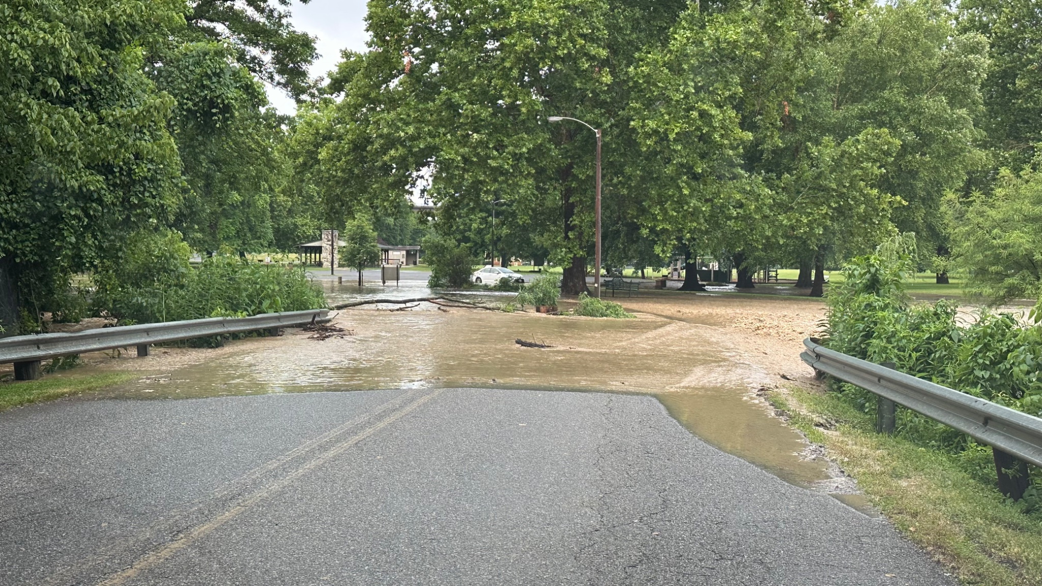
Chantal was well forecasted
It’s a little unfair to say the system “snuck up” on us, though it sort of felt like that.
The region off the coast of the Carolinas and Georgia was circled for days by the National Hurricane Center for possible tropical development. That was even mentioned here a week ago near the end of an article about how the Fourth of July weekend looked not as hot and quite dry — which almost all of it was, until late Sunday turned damp to soaking along and east of the Blue Ridge.
And some of the forecasts in North Carolina and Virginia on Sunday almost perfectly colored the counties that got the heaviest rain, which did prove to be even a little more than expected where it was the worst.
The National Weather Service office in Blacksburg had only one Virginia county, Halifax, under a flash flood watch early Sunday. Other counties were eventually added, but the county first highlighted about 18 hours in advance was the hardest hit — a tremendous forecasting success.
Thankfully, the central North Carolina and Southside Virginia flooding has not resulted in nearly the same death toll the Hill Country of Texas has suffered, but it is one too many — an 83-year-old woman died in an automobile in North Carolina floodwaters. 
Texas tragedy
There are no words worthy of being expressed that can remotely encapsulate the heartbreaking horror of the Texas flooding, particularly surrounding the young girls and some of their adult counselors swept away while at summer camp. The death toll has climbed over 100 and there are still many missing.
That said, given the similarly deadly and destructive inland impacts of Hurricane Helene on western North Carolina, Southwest Virginia and parts of surrounding states just this past fall, there should certainly be a lot of regional empathy for what central Texas is going through.
The Guadalupe River near Kerrville, Texas, rose 26 feet in 45 minutes during Friday’s flooding. The most similar case in Virginia’s weather history is with Hurricane Camille’s remnants over Nelson County in 1969, when the Tye River may have risen about 30 feet in an hour.
The combined impact of terrain effects and tropical moisture — the system over Texas wasn’t strictly a tropical cyclone but did include some infusion of moisture from Tropical Storm Barry — is a commonality between our region’s worst floods historically and those that just hit central Texas’ rugged Hill Country.
Also, as we discussed here with Helene, there is the push and pull between how the Guadalupe River has flooded severely several times in its history and it being nothing new, and the concept that warmer oceans and warmer air temperatures on average allow the atmosphere to contain and condense more water vapor, making torrential rainfall episodes more frequent. Both thoughts can have truth. 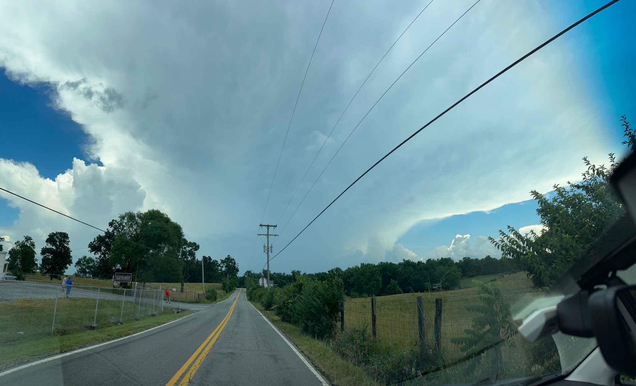
Questions are swirling about whether DOGE-related layoffs, retirements, and funding cuts impeded some of the forecasting, or communication of the forecasts, for the event, with deep concerns about how future budget cuts to National Weather Service entities in the recently passed omnibus bill may affect public safety in light of this catastrophe.
It does appear that timely watches and warnings were issued by a National Weather Service office in San Angelo, Texas, that staffed up to five people when two would have normally been working, but there are also questions about whether those warnings were properly received and/or heeded in hardest affected areas.
These are not issues keyboard warriors with hot takes and memes are going to solve, but only a level-headed, nonpartisan reckoning of all the facts after the search-and-rescue missions have concluded with an eye toward improving procedures — and potentially policies, at the local, state or national level — in the future.
Some of the social media rhetoric around the tragedy is dismaying.
Whether it’s Texas flooding or California wildfires or a disaster in any other state, be it “red,” “blue” or “purple,” no one deserves tragedy based on who they voted for, who their parents voted for, or who their county, region or state voted for.
Basic human compassion for those who are hurting, and a desire to learn from the tragic events and hopefully mitigate an inevitable similar one somewhere in the future, should overwhelm any and all partisanship in tragic events like this.
Thankfully, stories of heroism and humanity are coming to light as well, such as a Coast Guard swimmer who saved at least 165 people.
It will be our region’s turn again someday for a widespread weather disaster. But for now, let’s be supportive of our North Carolina neighbors cleaning up from a sudden deluge and those in the Texas Hill Country whose lives have been wrecked by a roaring river. 
Journalist Kevin Myatt has been writing about weather for 20 years. His weekly column, appearing on Wednesdays, is sponsored by Oakey’s, a family-run, locally-owned funeral home with locations throughout the Roanoke Valley. Sign up for his weekly newsletter:
